PRICE
$36900
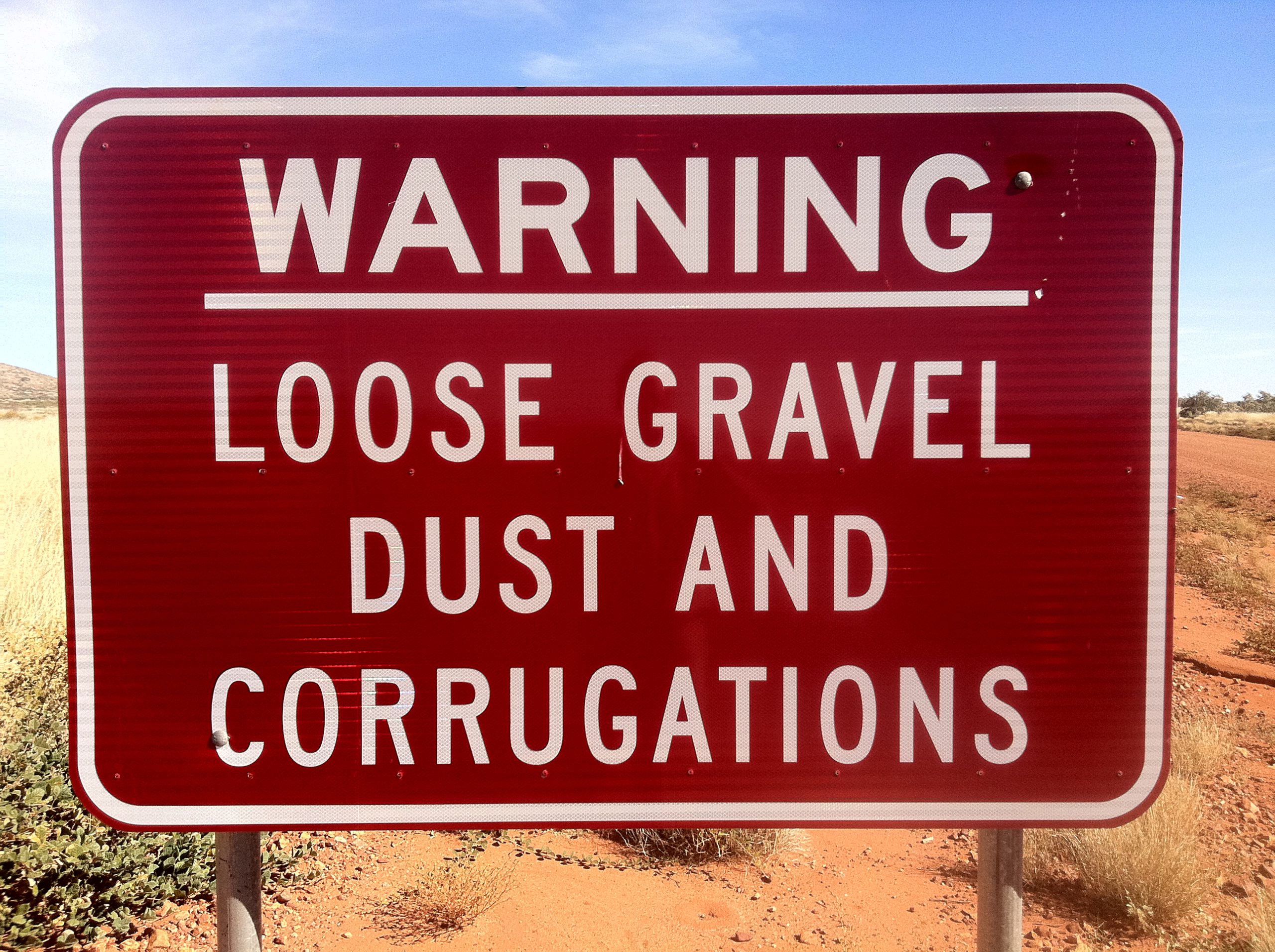


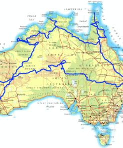
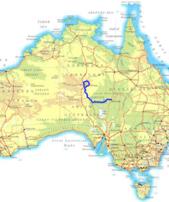
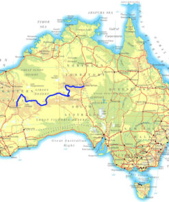
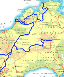
This is the Big One — a full 123-day 4WD lap of Australia, zigzagging through the most fascinating corners of the Outback. From rugged tracks and desert plains to rainforests and remote coastlines, this epic expedition goes everywhere worth going. Swim in waterholes, fish for barramundi and uncover iconic landmarks. It’s a once-in-a-lifetime journey packed with adventure, nature and culture.
An epic four-wheel-drive tagalong tour around Australia.
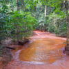
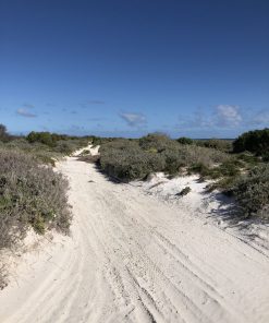
Experience sand driving, dune climbing, tropical rainforests, stunning vistas, outback towns, cattle country, beautiful coastlines and remote locations. Swim in rivers and waterholes. Catch barramundi off the beach. Cross deserts and drive for days on end without seeing another vehicle. Experience the most remote locations on Earth!
This adventure combines all our individual tours into one unforgettable journey.
PRICE
$36900
DURATION
123 Days
DISTANCE
21570 km
START LOCATION
Byron Bay, NSW
PERCENTAGE OF BITUMEN / DIRT: 20/80
AVERAGE DISTANCE PER DAY: 175km
GROUP SIZE: 6-10 vehicles
GLAMPING OPTIONS: 65 out of 123 days
TOUR START LOCATION: Byron Bay, NSW
TOUR FINISH LOCATION: Byron Bay, NSW
ACCOMMODATION: Bush Camps & Campgrounds
TOUR GRADE: Medium. No Trailers or caravans.
220km (B D)
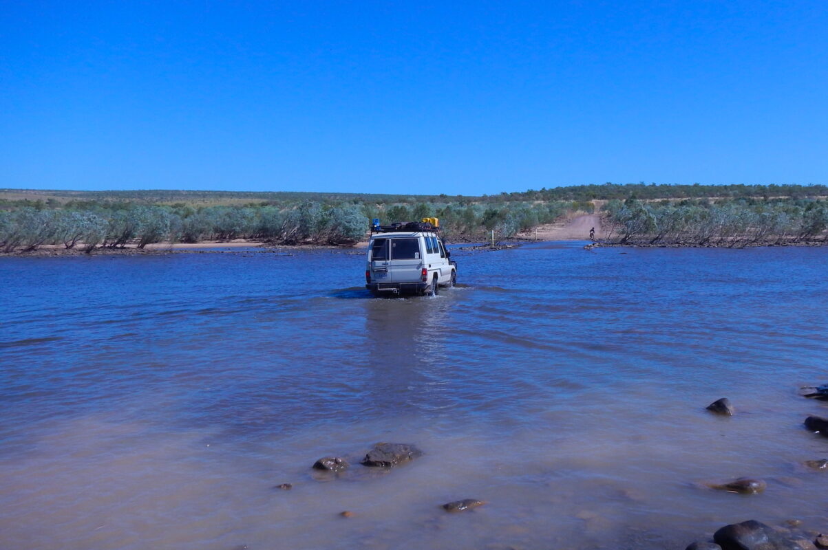
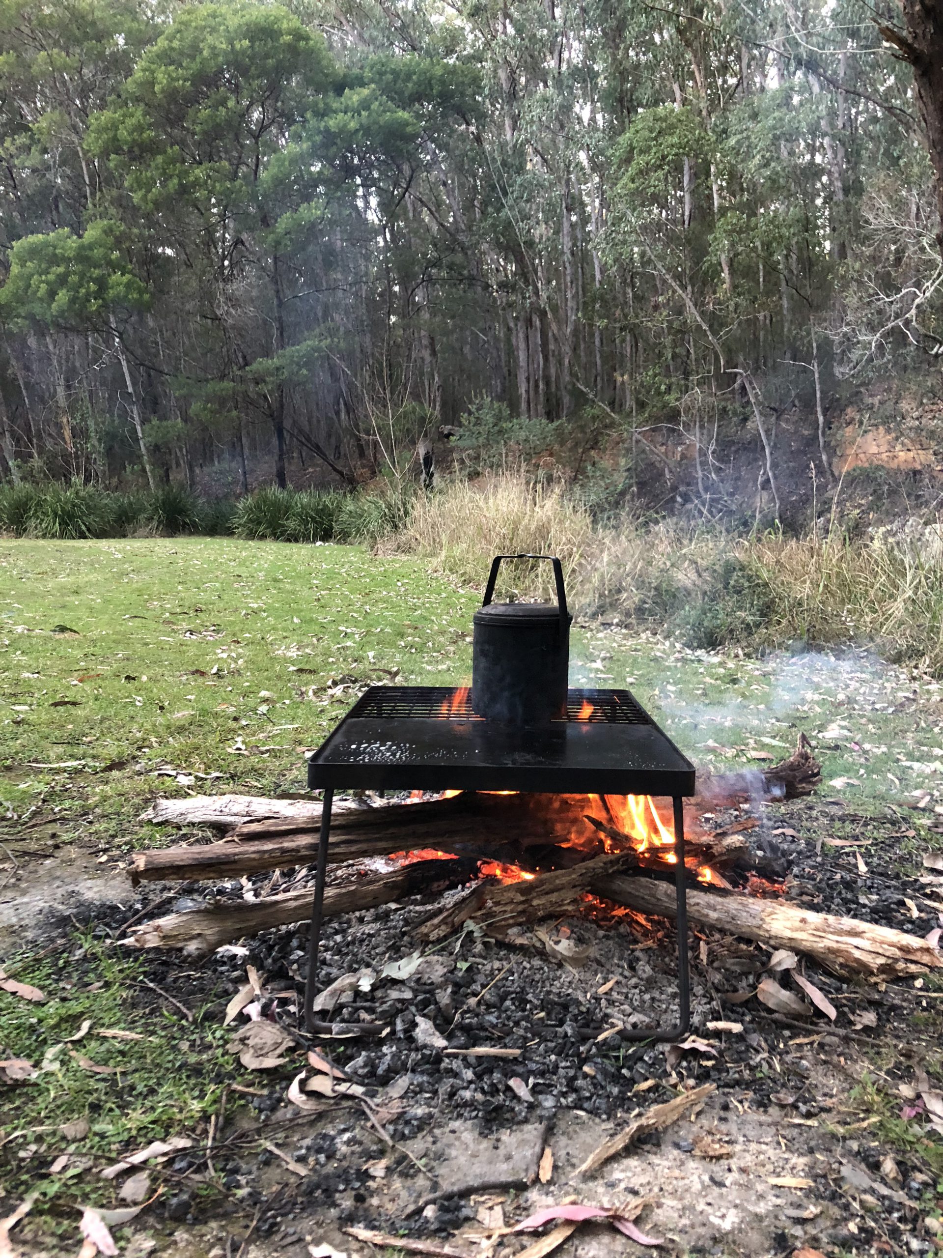
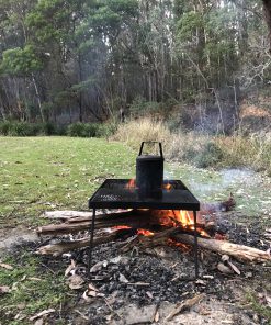
This tour kicks off at the easternmost point of Australia. After a photo or two at Cape Byron, it’s time to turn west. With a mix of gravel roads and blacktop we get to the headwaters of the Condamine River. The drive along the river is breathtaking with over ten river crossings before we get to Killarney. The afternoon’s driving is mainly on gravel country roads to our overnight bush camp at Hogan Creek. With Day 1 complete, it’s time to tell a few stories around the campfire.
433km (B)
We spend the morning following the course of the Condamine River to its headwaters at Slatters Crossing. We then continue along country roads for the rest of the day before arriving at Barakula.
327km (C M R)
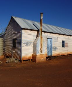
Continuing north on country roads and gravel tracks, we arrive at the small town of Injune, where a hot shower awaits, followed by a meal at the pub.
126km (C)
Today we head for Carnarvon National Park, aiming to arrive early after a short morning drive. This leaves you with most of the day to explore the magical surrounds of the park at your leisure.
289km (B)
As we head out of the park on winding country roads, we soon find ourselves back in the black soil country, making our way toward the Barcoo River. It’s another reasonably short day, giving us a good chance to catch some fish and red claw for dinner.
275km (B)
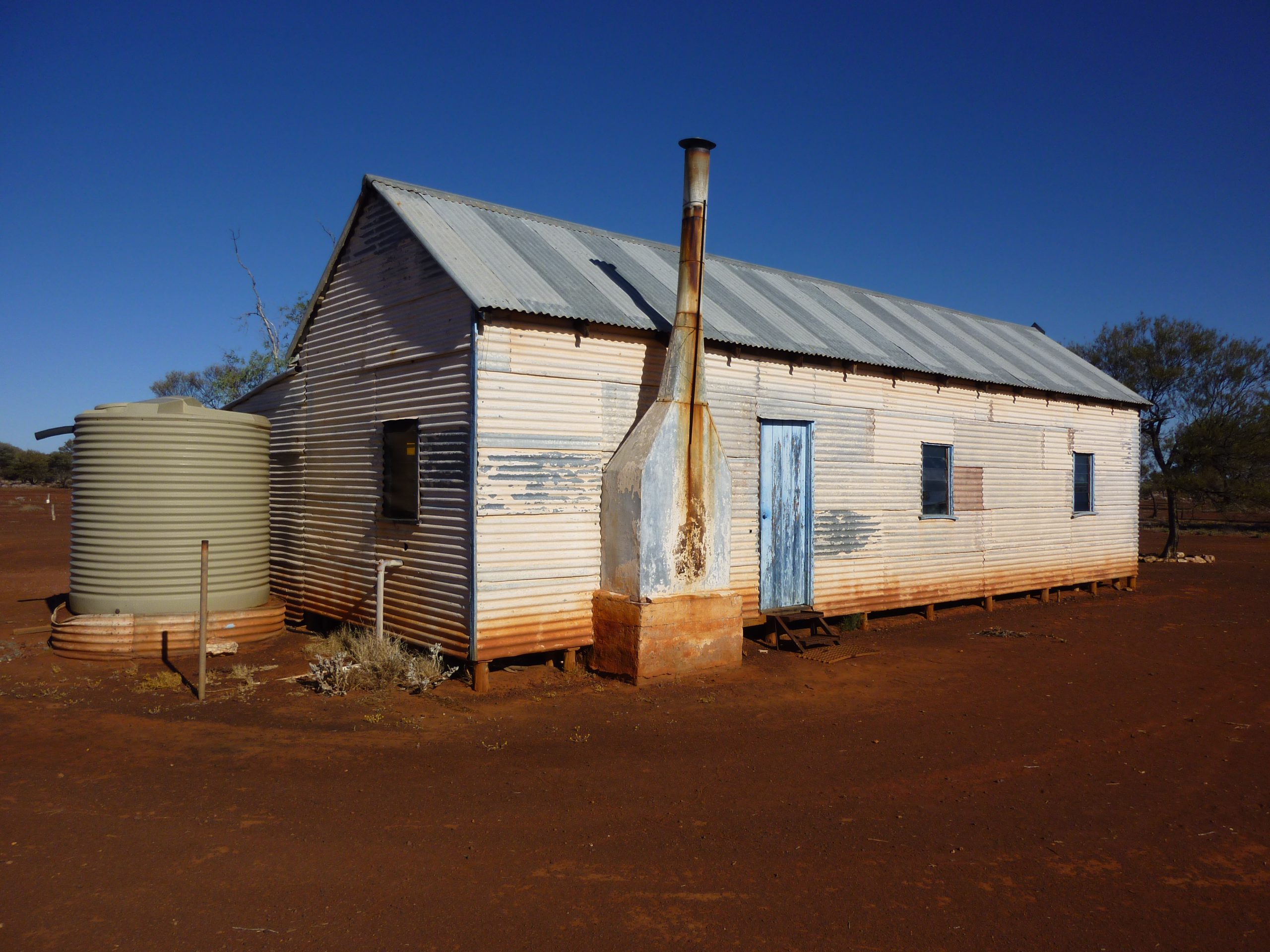
Hopefully, we’ll get a chance to put another fish or two in the freezer before we break camp. We travel along station roads for most of the day, eventually arriving at an old Cobb & Co post, where they used to change out their horses.
556km (C D R)
We have a big day ahead. After an early breakfast, we continue north.
62km (C)
After yesterday’s long day, we have a shorter, more relaxing one today. We arrive early at Porcupine Gorge, giving us heaps of time after setting up camp to explore this amazing area.
317km (C M R)
It’s only a short drive today as we make our way to Undara Resort. After lunch, we’ll take a tour of the lava tunnel.
240 km (C D R)
On our way to Cairns, we travel through the old goldfields, where traces of bygone days are scattered everywhere. Most of today’s drive is on sealed roads as we head back towards the coast and civilisation. We make one last stop at the Kuranda Markets before heading down the range and continuing on to Cairns. After settling into our campground, it’s time for dinner in town.
0km (C M R)
Cairns offers a wide range of tourist activities. You might want to visit the Great Barrier Reef, go on a crabbing trip down the river or visit Green Island. There are also plenty of things to do on land like visiting the new Cairns Aquarium. It’s truly incredible. There’s something here for everyone.
0km (C M R)
Today is another free day. It’s a good chance to spend a bit of time making sure your vehicle is 100% as tomorrow we head off on the Cape York leg of this trip around Australia. It’s also your last opportunity to stock up and provision for the next few weeks, since there aren’t many supermarkets north of Cairns.
205km (C D R)
Leaving Cairns behind, we head back over the range to the Tablelands, passing through the rich soil of the North’s Food Basket. We continue further west into the goldfields before arriving at Chillagoe for a tour of the Chillagoe–Mungana Caves. After setting up camp, it’s off for a meal at the restaurant.
202km (B)
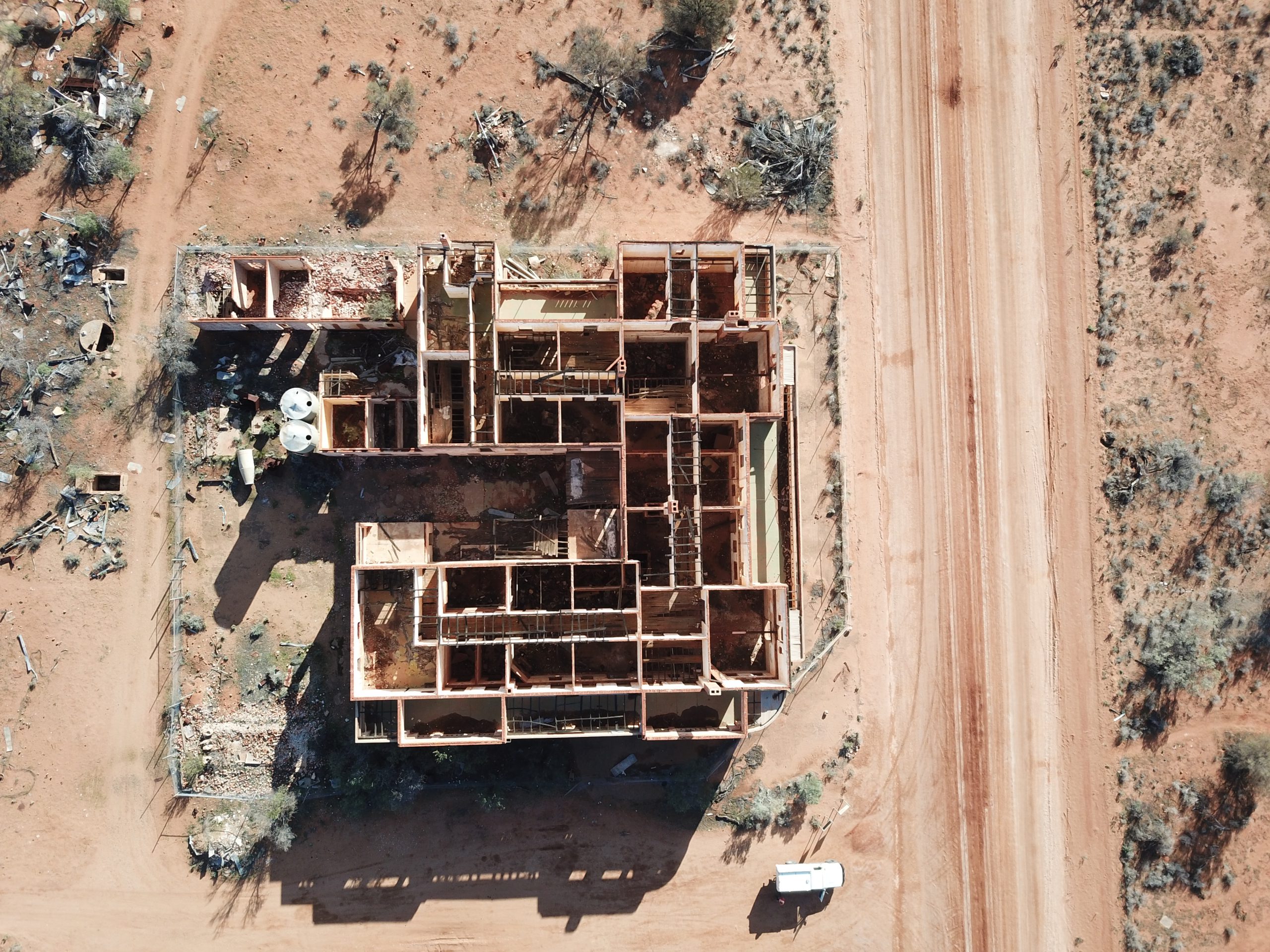
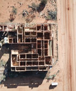
Today is all dirt roads as we turn north and continue deep into the Palmer River Goldfield, the site of Australia’s richest alluvial field. The going gets a bit rough in places, but we aren’t in a hurry, so we can take it easy. By mid-afternoon, we arrive at the ruins of Maytown. There are remnants of the gold rush everywhere—it’s great fun just poking about and checking the place out.
258km (C M R)
Even though today’s destination is only 30km away as the crow flies, it will take us all day. The old road north is very rough these days, so we detour around. Even so, the road out is still rocky and slow-going, but the scenery is stunning. After we get back onto the blacktop, it’s easy going for a few hours as we pass through Lakeland, then stop at Laura for a look around town. The short afternoon drive into Jowalbinna is on a well-formed dirt road. The campground here is fantastic, with nice hot showers and a roaring campfire—where you might hear a yarn or two.
211km (C M R)
After breakfast, we head off on a very informative tour of the Aboriginal rock art. Then it’s back onto a mixture of gravel and sealed roads as we make our way to our overnight destination at the old Musgrave Telegraph Station.
267km (C M R)
We continue north on the Peninsula Developmental Road (PDR) today. The road is quite good, with a mixture of gravel and bitumen. It’s a nice, easy day with plenty of photo opportunities. We stop in at Coen for a lunch break and a refuel, then arrive at Merluna Station early in the afternoon.
119km (C D R)
After a short drive to the mining town of Weipa, we take an early afternoon mine tour. Then you’ll have the rest of the day to explore the town before enjoying dinner locally.
173km (C M R)
You’ll have another chance to explore the town before a noon departure. We take the Batavia Downs shortcut through to the PDR, then continue north to Bramwell Station.
106km (B)
If you enjoy a bit of beach fishing, then tonight’s camp is the spot for you. We’ve caught plenty of delicious meals on this beach over the years.
93km (C)
After the winding track from Captain Billy Landing back to the PDR, we continue north to Fruit Bat Falls—the first of three waterfalls for the day. Our camp is at the picturesque Eliot / Twin Falls, where the swimming is first-rate.
120km (C M R)
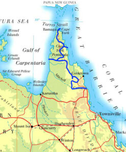
Continuing north on the PDR, we cross the Jardine River by ferry—it’s a short 50m crossing. We stop in at a WW2 wreck on our way to Loyalty Beach Campground.
100km (C D R)
We drive to “The Tip” today. We try and time the tide so we have a nice easy walk the last 400m to the most northern point of mainland Australia.
0km (C M R)
Today is a free day to catch up on bits and pieces, do a bit of fishing or just check out the local sights.
88km (B)
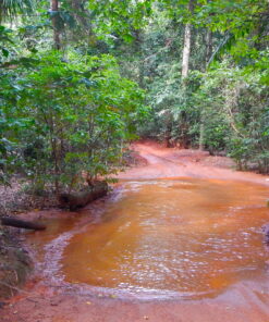
We turn south today and retrace our steps down to the Jardine River. After the crossing and a short section of the PDR, we turn east on to the Old Telegraph Track. The rest of the day is slower going as the track is quite challenging. We make camp at Nolans Brook, a fantastic swimming spot.
38km (C)
The first challenge of the morning is getting across Nolans Brook, a spot notorious for drowning vehicles. We’ve done it many times and will get you across safely. The rest of the day is spent tackling the Telegraph Track. Some of the creek crossings will test your four-wheel driving skills and your vehicle. We finish the day with a swim at Eliot Falls.
58km (B)
After a refreshing morning swim and a short stint back on the PDR, we reach Cockatoo Creek, the start of the Southern Section of the Old Telegraph Track. Before arriving at our overnight camp, we tackle Gunshot Creek. This technical crossing often catches novices off guard, but we’re there to guide you through it. After successfully crossing six creeks today, we finish at the beautiful Dulhunty River. It’s a great camp spot with safe swimming by a small waterfall.
70km (C M R)
After yesterday’s big day, today is a bit easier. The final crossing of the Telegraph Track at Palm Creek is a tough one. The winch will get a workout on this one. Not long after the crossing, we finish the Old Telegraph Track at Bramwell Junction. In the afternoon we continue along the PDR, collecting firewood on the way to our overnight camp at Morton Station.
189km (C D R)
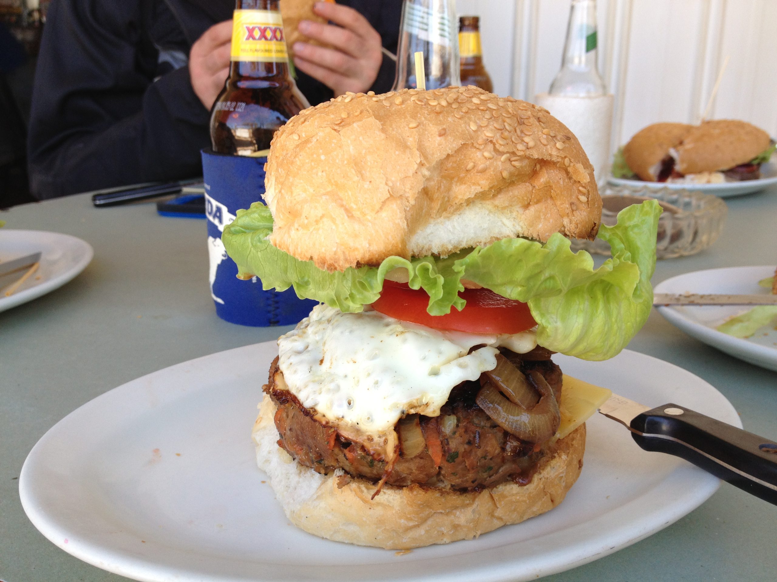
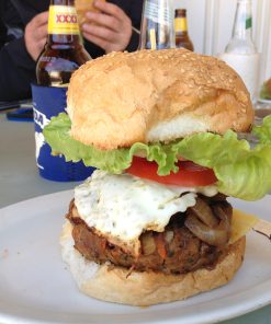
We continue on the PDR all day today. It’s a nice easy day with a stop at Archer River. They make the famous Archer Burger, the best burger on the Cape. It’s also a great spot for a swim in the Archer River. We finish the day at Coen, where there’s a general store to replenish supplies. Dinner is at the Exchange Hotel.
261km (C)
Half an hour after leaving Coen we turn off the PDR for the last time and head east towards the coast.We engage 4WD again as we join the Running Creek track, a fun trail takes us all the way to Lily Vale Station and back onto a graded road. A little further on we enter the magical Rinyirru (Lakefield) National Park. There’s plenty to see along the way to our overnight camp at Kalpowar Crossing.
157km (B)
There are barramundi to be caught in the Normanby River, so if you fancy a feed of fish, an early morning cast could be well worth it. After crossing the Normanby we turn onto the Starke Track, a scenic route with a few tricky spots to keep you on your toes. Tonight’s bush camp is one of my favourites.
144km (C M R)
After leaving the Starke Track we make our way into Cooktown. There’s time to look around, grab a coffee and drive to the top of Mt Cook to take in the same view Captain Cook saw when planning his exit. If you’re keen for a fish, the town jetty can be rewarding if the tide’s right. After Cooktown we head to our overnight camp at the famous Lions Den Hotel.
228km (C D R)
Today’s drive is especially scenic as we pass through World Heritage areas and stop at Cape Tribulation, where the reef meets the rainforest. We continue south to Cairns. After settling into your accommodation we meet up in the evening for dinner and a few tall stories from the Cape.
0km (C M R)
Cairns has a lot of tourist activities to offer. You might visit the Great Barrier Reef, take a crabbing trip down the river, or explore Green Island. There are also plenty of things to do on land, like visiting the Cairns Aquarium—it’s truly incredible. There’s something for everyone here.
0km (C M R)
Today is a good chance to provision for the next leg of the trip. It’s a long stretch between supply stops as we head west.
297km (C D R)
The first stretch of the trip is a short drive through town before heading up and over the Kuranda Range to the Tablelands. We wind our way west through the old gold mining area, then hit the dirt road for the first part of the adventure. Coming down the other side of the range, we head deep into cattle country. We arrive at Undara Resort just after lunch with plenty of time to set up camp and relax before meeting up again for dinner in the restaurant.
241km (C M R)
After breakfast we carry on west along station roads and through small outback towns, arriving at Cobbold Gorge in the afternoon for a tour of this magnificent natural wonder.
362km (B M)
Our destination today is our fantastic bush camp on the banks of the Norman River.
401km (C D R)
We’ve got a big day ahead as the roads begin to deteriorate and we start to see some small river crossings. Continuing southwest, we stop in at Leichhardt Falls, then head on to our refuel point at Gregory Downs. As we push west, we drive into the afternoon sun and arrive at Adels Grove and Lawn Hill National Park.
473km (B)
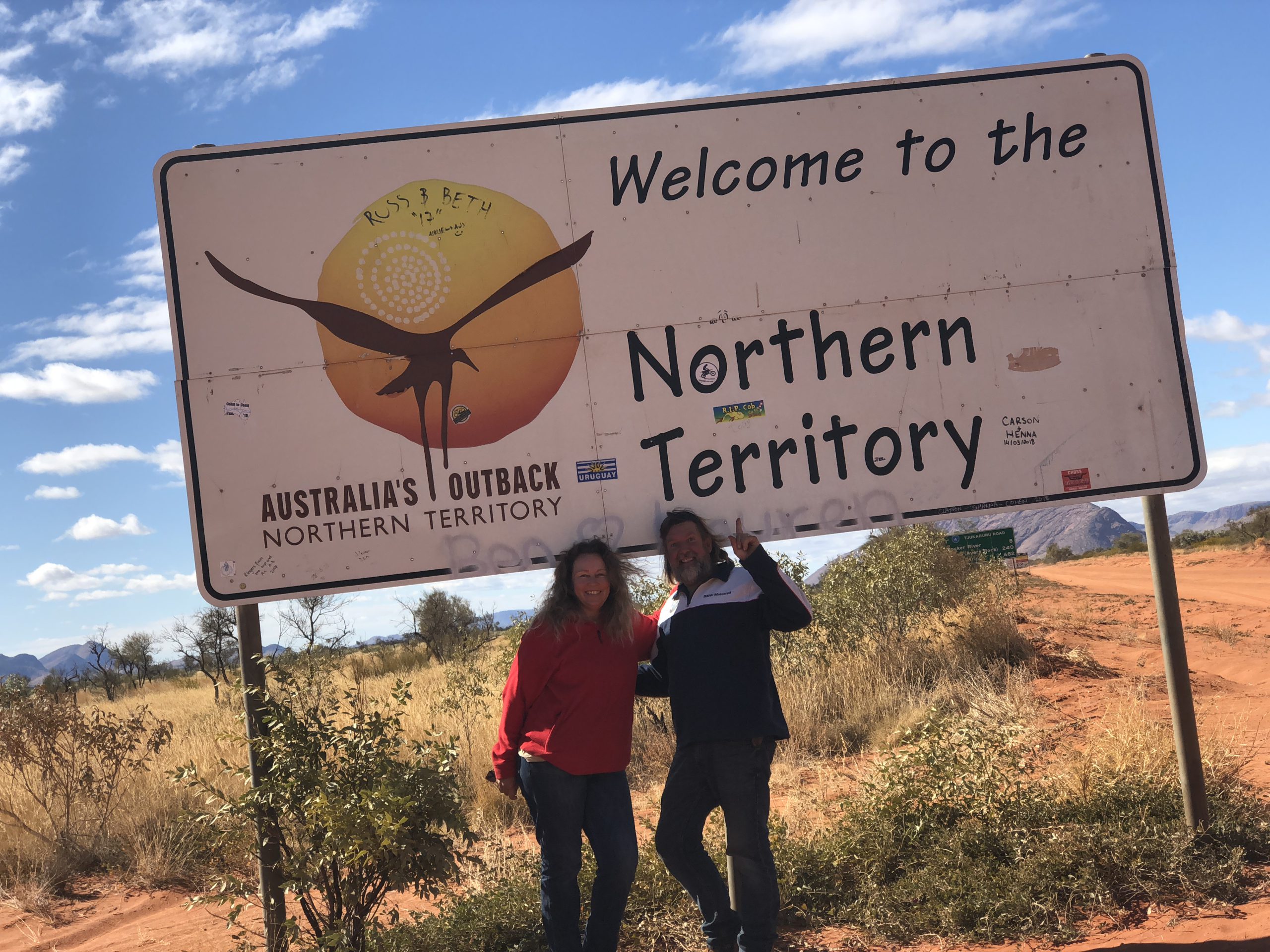
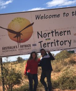
We head off for an incredible drive and our first taste of real river crossings, some quite deep. We cross a dozen or so water crossings today, heading into Savannah country and once again turning north. Our first stop is at Hells Gate for a refuel, then we continue to our lunch stop near the QLD/NT border. Now into the Northern Territory we continue along the Savannah Highway. If we arrive early enough, our camp tonight is one of the best camp spots you will see. We even have our own waterfall. If it’s already taken, the alternative isn’t too shabby either.
227km (C M R)
It’s hard to leave this campsite, but after another bush breakfast we head off early and continue north across numerous rivers to refuel at Borroloola. On the way to our lunch spot on the Tawallah Range, you’ll notice the road deteriorates and becomes ideal for four-wheel driving. After lunch we continue north and cross some big rivers. Our camp tonight is at Lorella Springs.
0km (C M R)
There’s a good chance of a barra for dinner tonight if we get a lure in the water before dark, but keep an eye out for the crocs.
152km (C M)
If you haven’t had any luck with the fishing, there’s another chance in the afternoon as we set up camp on the banks of the Towns River.
312km (C D R)
We follow the Roper River west to the small community of Roper Bar. After a refuel and a short stint on the blacktop, we reach the oasis known as Mataranka Homestead Resort. It’s a great spot for a swim in the crystal-clear waters. We meet up again in the evening for dinner.
143km (C M R)
There’s time for a morning dip before we turn onto the Stuart Highway and head north to Nitmiluk (Katherine Gorge). We arrive at noon, so there’s plenty of time to join one of the many tours or simply relax by the pool.
283km (C M R)
Today is a big day after yesterday’s short drive. We continue north on the Stuart Highway, then turn onto the Kakadu Highway. We pass through old gold mining areas before entering Kakadu National Park. The scenery is breathtaking as we make our way to our two-night stop at Gagadju Lodge.
0km (C M R)
There are plenty of tours and excursions to do here, so plan ahead to make the most of your time at Kakadu.
130km (C M R)
Today is our last off-road day before Darwin. In fact, there are a couple of challenging sections. We spend the day on the Old Jim Jim Road, with a few water crossings and some magical scenery along the way. By mid-afternoon we arrive at the Mary River Wilderness Retreat and it’s time for a swim in one of the pools.
113km (C D R)
We leave the beautiful Mary River Wilderness Retreat behind and make our way along good sealed roads to Darwin. On the way we stop at the famous Humpty Doo Hotel, with a refreshing lunchtime break at Howard Springs before reaching Darwin. After settling into our accommodation, we meet up for dinner in town.
154km (C)
We head out of town and onto the dirt roads on our way to Litchfield National Park. The scenery is incredible as we wind along a rough track to the picturesque Tjaynera Falls (Sandy Creek Falls). We arrive reasonably early, just after lunch, so there’s plenty of time to set up camp and enjoy a swim in the falls.
143km (B)
The going gets quite exciting as we follow the Reynolds River south. There are quite a few creek crossings and a few tricky bits to test your driving skills. We stop at the magic Surprise Creek Falls along the way for another swim, then after lunch, make our way out of the park and head east through old gold mining areas before arriving at our overnight stop in Grove Hill.
345km (C D R)
We start off following the famous Ghan Railway south until we get on to the Stuart Highway. Stopping in at our last big town for quite a while, we take the opportunity to stock up at the supermarket and fill our tanks.
151km (B)
It’s worth getting up early to take in the escarpment walk at sunrise. We stop in at Bullita Homestead in the Judbarra / Gregory National Park then head to our overnight bush camp at Fig Tree Yard.
189km (C)
Today’s drive is something else. The whole day is spent on tight 4WD tracks. It’s rocky, sandy and muddy, with heaps of river crossings. Today’s travel is first class. We usually catch a barra or two at our lunch spot, so more than likely it’ll be fresh barra on the BBQ tonight. As we continue south after lunch, we’re still driving some of the best tracks the NT has to offer before arriving at our overnight camp in Kalkarinji and barra for dinner.
370km (B)
After a morning stop for fuel and supplies at the Kalkarinji Community store, we turn west onto the Buntine Highway. The Buntine is one of the north’s great cattle roads. We travel through vast tracts of grasslands, deep in the NT’s best cattle country. It’s a big change from yesterday, and we get a chance to relax as we head into the afternoon sun, cross into Western Australia, and reach our camp on the Nicholson River.
188km (C M R)
Even though it’s a short day today, we get going early so there’s time at the other end to check out Lake Argyle. There are a few sights to see along the way, and you can finish the day with a sunset tour on the lake.
173km (C D R)
Today’s destination is the famous El Questro Station. We leave Lake Argyle and head into Kununurra, where you have some time to look around, provision with fresh produce and restock the beer. After refuelling, we cross the massive Ord River and continue west on the blacktop for half an hour before hitting the eastern end of Gibb River Road. A short blast on the corrugations, and we arrive at El Questro.
0km (C M R)
There is a lot to do at El Questro. You can simply enjoy the peacefulness of the place or tackle some of the scenic tracks and walking trails. A range of tours is available, from thrilling helicopter rides to relaxing boat cruises.
339km (C M R)
After a sleep-in and breakfast we continue deeper into the Kimberley. The views are stunning, and the river crossings are great fun. You’ll find yourself stopping all morning to snap photos of the breathtaking scenery. The Kimberley region of Western Australia is breathtaking. We spend all day on the Gibb River Road before arriving at our camp spot on the banks of the Manning River.
213km (C)
We continue west along the Gibb River Road, winding through the dramatic King Leopold Ranges, which offer some of the most spectacular views in Western Australia. The day ends at the majestic Windjana Gorge, where bushwalks and tours are available.
283km (B)
We continue south and head for Tunnel Creek where the water has carved a tunnel through the hill. If the water level is low enough, we can walk or swim from one end to the other. After lunch and a short stint on the blacktop, we follow the Fitzroy River to our bush camp at the Fitzroy River Barrage.
317km (C)
We follow the Fitzroy River a little further, passing through the ruins of the Camballin Irrigation Project before rejoining the Number One Highway and cruising past some famous landmarks. The afternoon has us back on sandy tracks for some serious four-wheel driving action before arriving at our overnight camp.
133km (C D R)
The final day of this leg is an easy run into Broome, giving us plenty of time for sightseeing along the way and a tour of the town once we arrive. We all get together for dinner tonight at the historic Roebuck Bay Hotel.
0km (C M R)
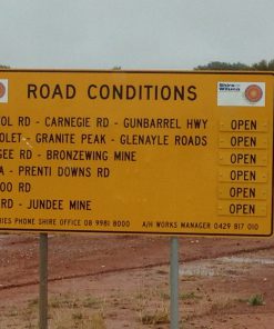
Today is a great opportunity to get your four-wheel drive serviced and ready for the next and toughest part of the trip: the Canning Stock Route (CSR). While your vehicle is being serviced, why not book one of the many tours available in Broome.
0km (C D R)
It’s time to provision and get everything you need onboard for 21 days in the Outback. We get together tonight for dinner in Chinatown.
291km (B)
Most of today’s driving is on the blacktop. It’s a good time to relax and get ready for an amazing trip across the deserts.
175km (B)
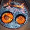
It’s off-road all day today, with a few hours of sandy stuff to make sure everything with the vehicle is running smoothly. We finish at Cherrabun Station, where we usually have a big cook-up around the campfire. It’s a great opportunity to share camp oven cooking tips.
293km (C R)
We get in to Halls Creek at noon, just in case you need to get any last minute bits sorted. This is also where we get some last fresh fruit and veggies and fill all our tanks to the brim ready for the CSR.
152km (B)
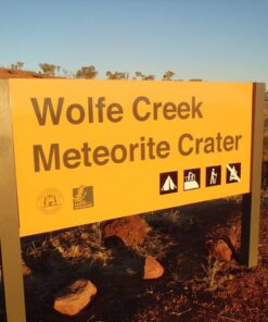
We’ve kept this day short in case there are any last-minute repairs needed on the vehicles. We head off around noon and arrive at Wolfe Creek by mid-afternoon, giving us plenty of time to set up camp and trek onto this incredible crater.
215km (B)
The first day on the CSR is a fairly easy one. It’s a last chance to buy an ice cream for a week or so as we pull into Billiluna Aboriginal Community. A little further down the track, we reach Well 51, then continue along a narrowing track that gets sandier the further we go. We take a side track to visit Well 50 before pulling up short of Well 49 in a nice wooded area to set up our camp.
162km (B)
Our first stop is at the restored Well 49, then we continue south. The track gets a bit rocky in sections as we pass the Breadon Hills. We take a few side trips to visit some of the wells along the way to our camp. There’s a chance to fill up our water supplies at the restored Well 46.
158km (B)
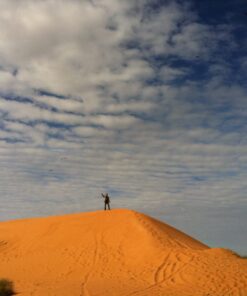
The dunes get bigger today as we head deeper into the desert. After crossing Lake Guli, the track gets more interesting as it winds its way over and around the dunes. We cross Lake Tobin before arriving at our camp just short of Well 39.
161km (B)
After Well 39, we leave the Great Sandy Desert and head into the Gibson Desert. It’s a busy day with the steering wheel as we wind along the track all day with a combination of very sandy and rocky sections. Tonight we camp at the Kunawarritji Community campgrounds. There’s also a chance to provision here, as there’s a small general store. We refill all our fuel tanks and top up our water tanks.
188km (B)
With the vehicles full of fuel, food and water, we head south once more. The track gets a little rocky today until we reach Well 30, where the dunes start again.
113km (B)
We stop in at Well 26 to refill our water supply, then it’s back into the dunes for a while. Once we reach the Talawanna Track, the going gets easier all the way to our camp at Georgia Bore. We’ll be here for two nights, as tomorrow is a free day.
0km (B)
Today is a great day to catch up on some domestic duties, like a load of washing, as there’s a good supply of fresh water. It’s also a good opportunity to repack and give your vehicle a good once-over.
0km (B)
We use this day as an emergency catch-up day, or in case any vehicles need major work. There’s also an opportunity to head into Newman Township for repairs.
182km (B)
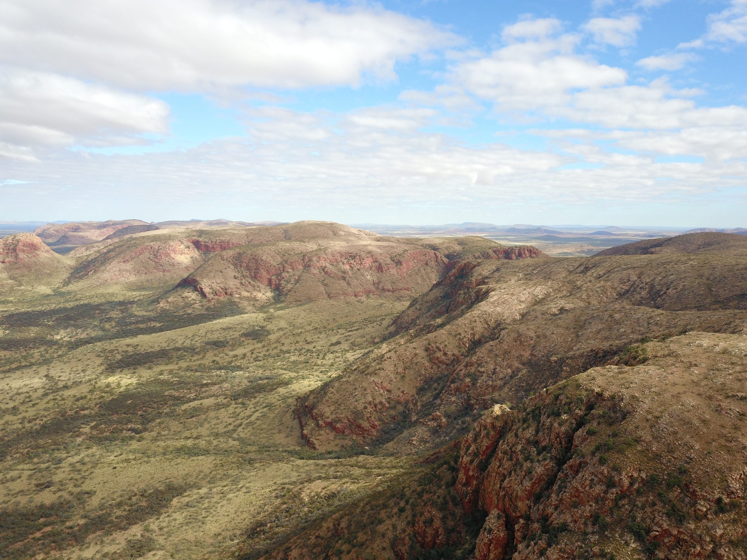
Today is full of highlights. First up, we cross from the Gibson Desert into the Little Sandy Desert. A little later in the day, we arrive at Lake Disappointment. We then cross the Tropic of Capricorn before getting back to some challenging sand driving. Late in the day, we turn off the CSR and head to Durba Springs for a relaxing two-night stop.
0km (B)
If you’re into photography, this area is absolutely incredible.
76km (B)
This is the last week of the CSR. No more free days until you reach Perth. The driving today is quite relaxing, and we have time to soak up the last of the dune country before arriving at our camp. There’s plenty of fresh water in the well to refill our tanks.
71km (B)
Today is another easy driving day, with plenty of opportunities to stop and enjoy the solitude. Keep a good lookout, as we usually see lots of camels around here.
135km (B)
As we get closer to Wiluna, there are more and more signs of civilisation. Our destination today is the beautiful Pierre Spring and the restored Well 6. This is a wonderful campsite.
126km (B)
We are in station country for most of the day. The driving is relaxing, and the views are stunning. Be sure to make the most of this last full day on the Canning, because tomorrow it’s back to well-formed roads and stop signs. Tonight, we camp at the beautifully restored Well 3.
138km (C R)
Today we get to the end of the CSR and can reflect on this amazing trip. The longest stock route on earth, and you have done it. As we get closer to Wiluna, your mobile phone will start beeping with all those messages and emails. There’s a chance for another ice cream as we refuel in Wiluna, and it’s time to get some ice back into the warm esky.
572km (B)
We have a lot of distance to cover today, but the roads are good and there are no dunes. We slowly ease our way back into civilisation as towns whiz past and road signs increase. Our last night camping in the bush is usually a big one. With plenty of stories and a big camp fire, we all reflect on this amazing country.
370km (C D R)
It’s an easy drive into Perth, with a mixture of off-road and blacktop. We stop at Noble Falls for lunch before descending the Darling Scarp into the suburbs and traffic. We all meet up for a farewell dinner and share stories from the journey.
0km (C M R)
It’s time to wind down, arrange for the vehicle to be serviced, and plan what to do over the next five days.
0km (C M R)
There’s no shortage of things to do. Perth is a vibrant modern city with plenty to offer.
0km (C M R)
Maybe take the ferry to Rottnest Island, or head south to the Margaret River wine region.
0km (C M R)
It’s time to provision again and get organised for the next stage of this amazing adventure.
0km (C M R)
Today is the last chance to make sure everything’s 100% for the next leg of the journey.
419km (C)
It’s an easy drive on highways all the way to our overnight camp.
395km (C M R)
Our first stop is Geraldton. This is the final chance to provision and fill all the tanks.
314km (C D R)
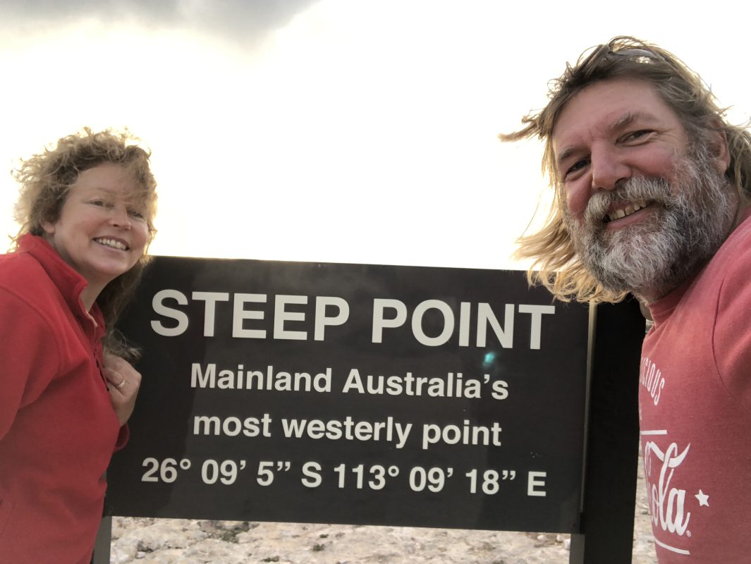
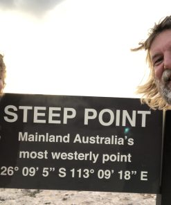
After meeting for breakfast at Hamelin Bay and a safety briefing we wind our way to the westernmost point of Australia. We will need 4WD and some air out of the tyres to get us to Steep Point. After some photos we head back to our campsite at Hamelin Bay.
276km (B)
Leaving the beautiful bay behind us we head in to Australia’s interior and into the rich sheep growing areas of yesteryear. By mid-afternoon, we arrive at our camp on the banks of the Murchison River.
256km (B)
As we travel further east we leave the goldfields behind and head into cattle country.
220km (C M R)
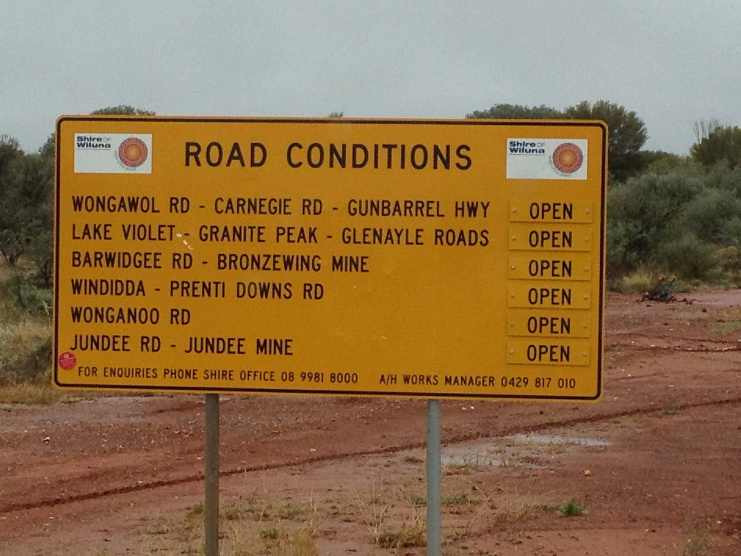
We continue further west into Western Australia’s rich gold mining belt and finish the day at Gunbarrel Laager, where a hot shower and a lovely country home-cooked dinner await us.
342km (B)
We spend the day in cattle country. There is also plenty of wildlife on this stretch.
0km (C D R)
Today you have a chance to catch up on bits and pieces, do some laundry, join us on a station trip, or just relax. We finish the day with a great meal at the station.
204km (B)
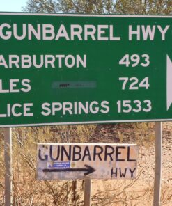
We continue east on the Gunbarrel Highway and it takes us deep into the Gibson Desert. We see our first sand dunes of the tour and end the day under the gum trees at Geraldton Bore.
158km (B)
It’s hard going all day as we battle some tricky sections of the Gunbarrel Highway. Just before the end of the day we turn off the Gunbarrel onto the Heather Highway, making camp not far from the intersection.
376km (B)
We hit the Great Central Road (GCR) after the Heather and stop in at the Aboriginal community of Walburton. After filling our tanks it’s time to head off and get back onto the GCR and a section of the Gunbarrel Highway.
421km (C D R)
Our first stop today is at the Aboriginal community of Warakurna for a refuel. Then it’s on to Giles Meteorological Station to see the grader that built the road you’ve been travelling on for the past few days. After morning tea, we continue on along the GCR to Lasseter’s Cave, where we’ll stop for lunch. By mid-afternoon, the majestic domes of Kata Tjuta (The Olgas) come into view. Then, just before we reach our camp for the night at Yulara Resort, the iconic silhouette of Uluru (Ayers Rock) comes into view.
0km (C M R)
There are so many things to see and do here. Just have a lazy day driving to The Rock and going for a walk around it or take a helicopter ride and see it from the air.
306km (C M R)
Leaving Uluru in our mirrors, we head east on the blacktop to the Lasseter Highway, then turn north towards Kings Canyon. The scenery on today’s easy drive is stunning. We arrive nice and early, giving you plenty of time for sightseeing.
228km (C M R)
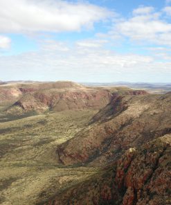
There is plenty of time in the morning to take in a morning walk or get some amazing sunrise photos. The scenery today is amazing once again. We continue towards the Macdonnell Ranges and check out a few sights along the way.
128km (C D R)
We stop at amazing sights all day on our way to “The Alice”. Along the way, we check out three different gorges: Standley Chasm, Simpsons Gap and the Alice Springs Telegraph Station. Then we head into town to refuel and restock. We meet up tonight for dinner in town.
155km (C R)
We leave Alice Springs at lunchtime giving you plenty of time to check out the town. On our way to Hale River we take in a few sights and visit the historic gold mining town of Arltunga. From there, it’s a short drive to our overnight stop at Hale River Homestead.
276km (B)
We arrive back in Alice Springs by noon to refuel, then head south along the Old Ghan Railway line. We will now be on dirt roads for the next seven days. We reach our camp by late afternoon, where the sunset views of Chambers Pillar are absolutely stunning.
221km (B)
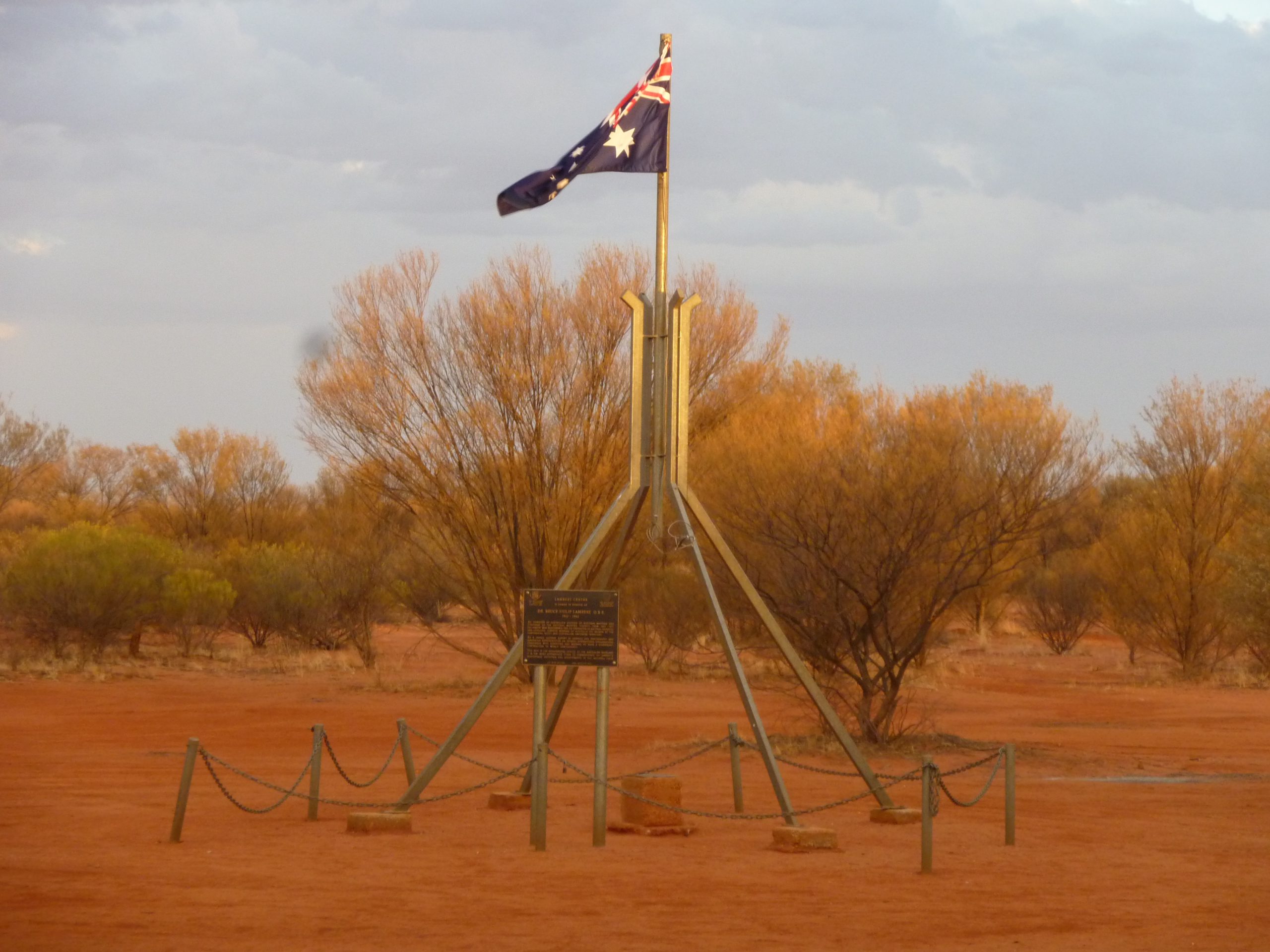
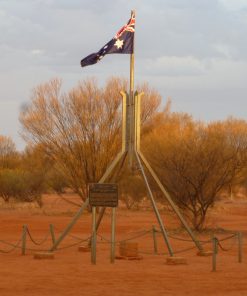
Our first sightseeing stop is Rodinga, one of the original railway stations on the Old Ghan. Following the railway line south we stop for a refuel in the Finke Aboriginal community. From there, it’s a short drive to our overnight stop at Lambert Centre, the geographical centre of Australia.
244km (B)
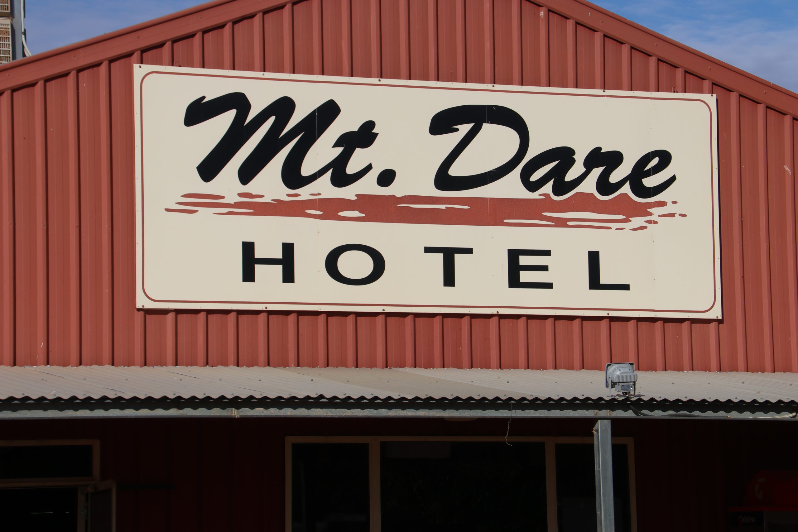
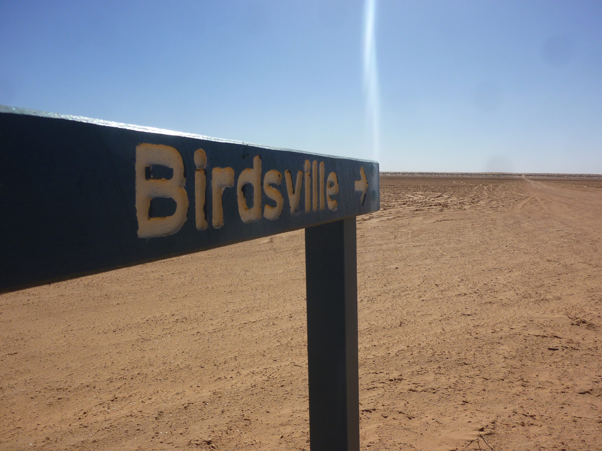
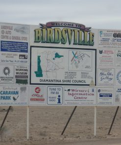
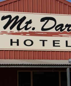
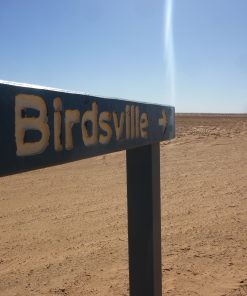
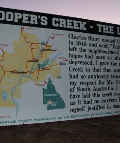
We stop at several historic sights from days gone by on our way to Dalhousie Hot Springs. Along the route, we also visit Mt Dare, which is our final fuel stop before reaching Birdsville.
123km (B)
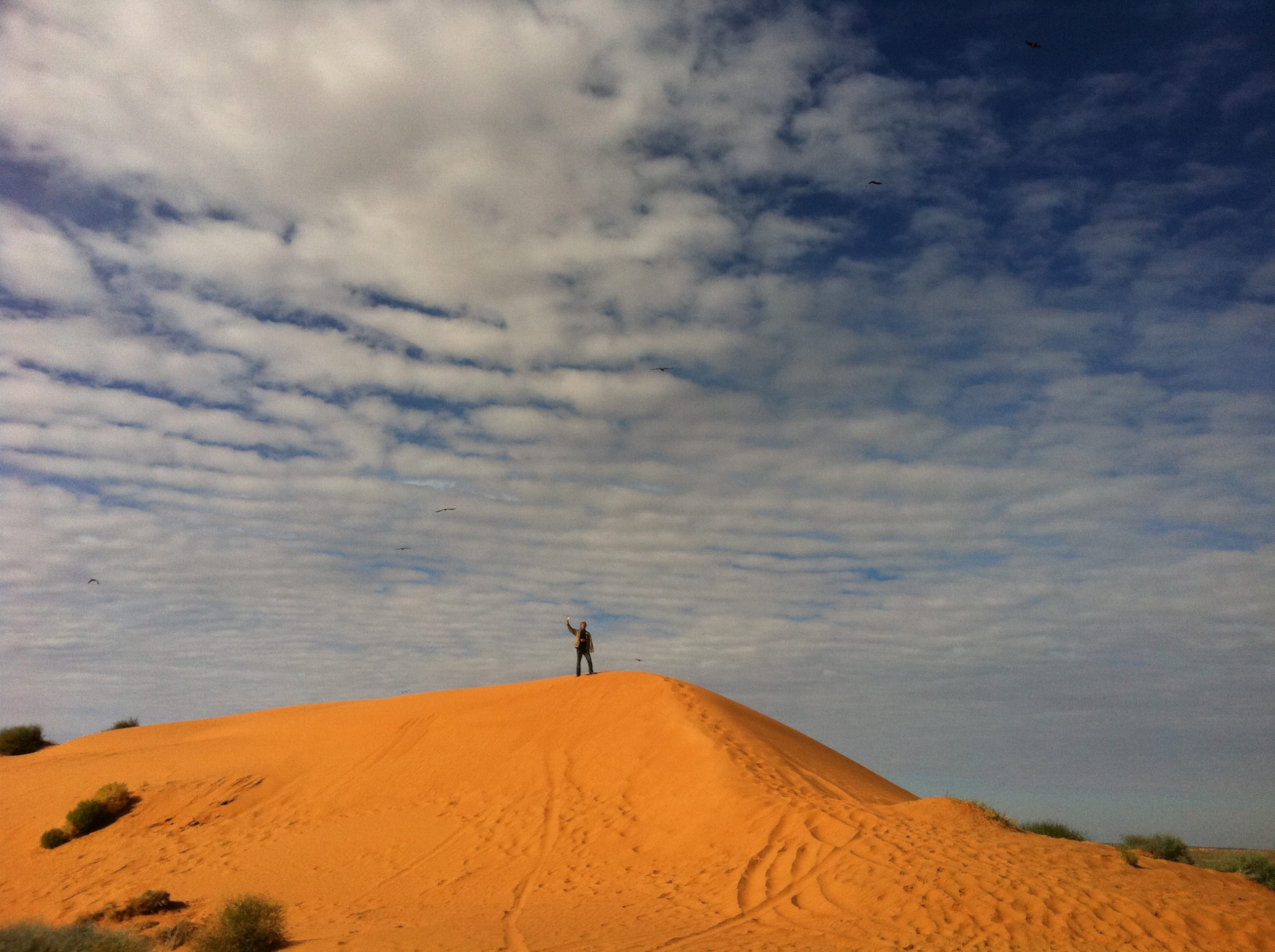
Today marks our first day in the Simpson Desert. The dunes start small and get bigger all day. The sights are amazing with plenty of photo opportunities.
Day 113
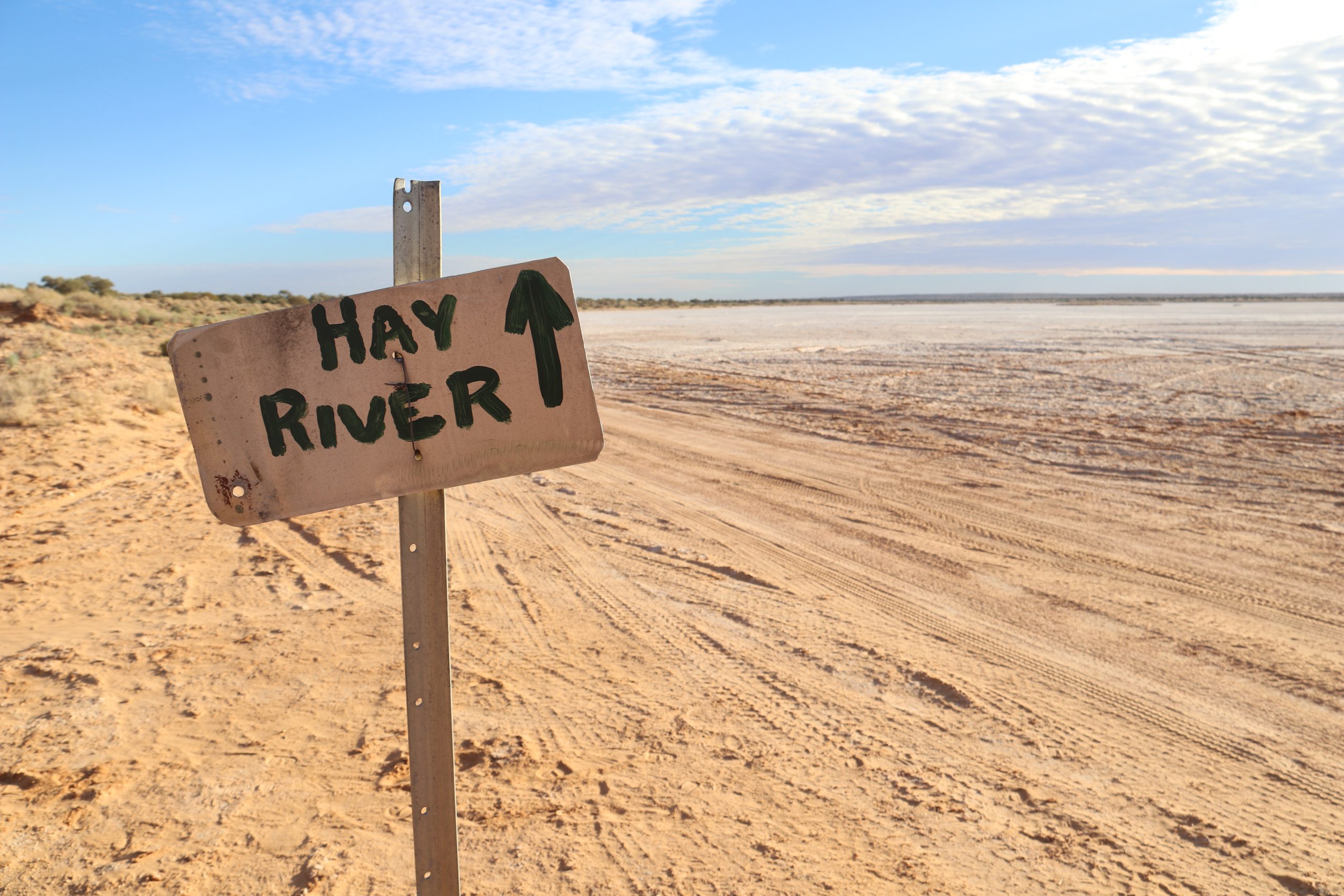
There are many abandoned oil wells in the area. We visit a few today on our way. After Lynnies Junction we head south then head east again along the Rig Road. We will set up camp not far from the iconic Lone Gum.
82km (B)
Another day in the dunes. The scenery along this section is amazing.
54km (B)
We visit the Approdinna Attora Knolls this morning then turn onto the French Line again after Lake Tamblyn. This section of the French Line is very soft so the going is slow with more amazing vistas. We camp at Poeppel Corner near the junction of South Australia, Queensland and Northern Territory.
166km (C M R)
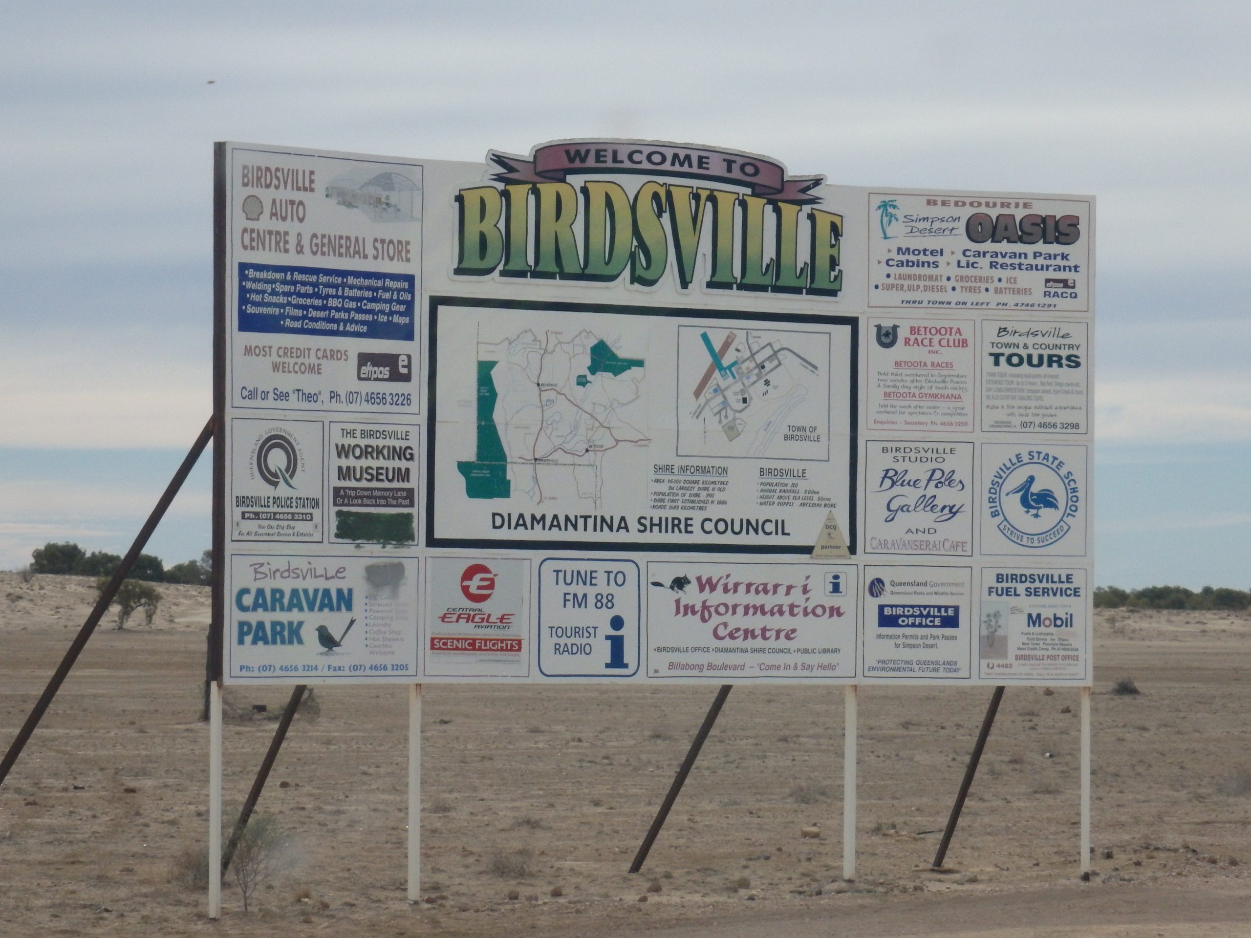
After a short stint on the K1 Line, we turn east again along the QAA Line and have lunch at Eyre Creek. We get to Big Red later in the afternoon and have some fun on the Last Dune. We get into Birdsville to setup camp, then it’s off to the iconic Birdsville Pub for a well-earned cold one.
0km (C D R)
There is plenty of time to check out town and spend some time at the races. Later in the evening, we head into town for a group dinner.
292km (B)
It’s an easy day today with no sand dunes. We stop at Cordillo Downs, home of Australia’s largest shearing shed, then continue through the Sturt Stony Desert. We make camp before we get to Arrabury.
45km (C M R)
It’s a big day on the road today. We head on through the Strzelecki Desert to our refuel at Innaminka, then stop for lunch at the Burke & Wills Dig Tree. As we leave the desert country behind and enter the Channel Country we have a smooth drive into Thargomindah on the bitumen.
369km (B)
Continuing east we spend the day on station roads and travel the Dowling Track to Hungerford then on via back roads to our overnight camp on the banks of the Balonne River.
350km (C M R)
The scenery really changes today as we drive along the border of NSW and QLD. We spend the night at a campground in Goondiwindi, with plenty of time to explore this amazing town.
250km (BMR)
We continue along the border and over the Great Divide. Spectacular scenery and lots of winding roads await us on the way to our creekside mountain camp before Drake. This is our last camp, so there will be lots of stories around the campfire tonight.
250km (C D R)
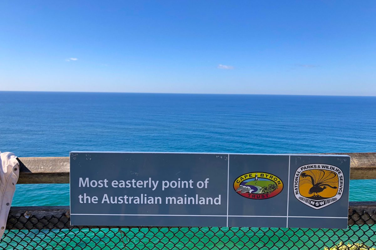
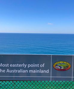
Our last day on the road doesn’t disappoint, with some off-road driving still to be done before we reach the easternmost point of Australia and the end of this incredible adventure. We catch up one last time for a farewell dinner in Byron Bay.
Legend
B – Bush Camp
C – Campground
D – Dinner Provided
M – Meals Available (own expense)
R – Rooms Available (own expense)